How to Use Aerial Imagery for Better Takeoffs and Increased Profits
Your customer properties aren’t one-dimensional, so you need more than a top-down satelitte image to show them your planned work. You need Go iLawn’s aerial imagery to show the smallest details or the biggest job.
Why do Landscapers Use Aerial Imagery?
Landscape contractors use aerial imagery to get the details of the property they need to measure and service.
Aerial imagery allows estimators to create accurate, detailed sitemaps when combined with Go iLawn’s precision measuring tools. It allows the estimator to create a visual communication tool to be used by salespeople, clients, and crews for their various needs.
Why do Landscape Estimators Need Aerial and Angled Property Images?
Aerial imagery prevents bid inaccuracies. Since your estimators can see every part of the job in resolution as clear as 5cm or better, you can be sure they don’t leave anything off of their estimate.
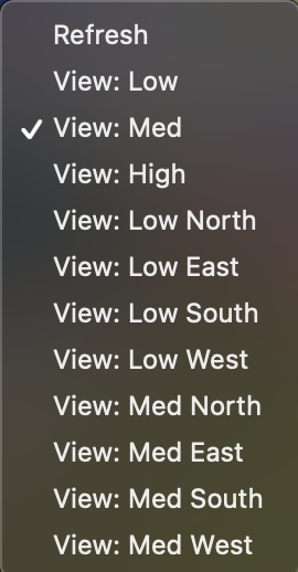
Go iLawn‘s Aerial Imagery not only shows low and medium overhead views but angle views for each as well. North, South, East, and West angles are available for both the low and medium aerial images, in addition to a High satellite view.
This helps them see details close to a building that may not be visible in an overhead view. For example, particularly tall buildings will cast shadows. Without angled views, your estimators could miss key job data like mulch beds or trees.
How does Aerial Imagery help Landscaping Sales Teams win?
When your estimators measure and create visual sitemaps, your salespeople are relying on the measurements and estimates to be accurate. This way, they can apply your pricing model and accurately bid the job. Forgetting to measure an area or over-estimating the size of a lot can and will cause your Sales Team to severely under or over-bid a job.
When your sales team offers a fair and accurate bid, presented with an impressive, color-coded sitemap, you gain a competitive advantage over other companies the prospect is considering. Exceptional work at a fair price means your customers will come back to you year after year.
Aerial imagery not only helps ensure bid accuracy, but it’s also a great sales tool! You’ll impress your prospects and clients with a color-coded, professional sitemap of their property. With our new Go iLawn ShareView™ feature, your prospect or client can even click around and see multiple views of their property and your job plan in an interactive, yet not-editable version of your project.
High-resolution aerial images are just the beginning of all the great features Go iLawn has to help you measure, bid, and win more jobs.
How does your team benefit from aerial imagery?
Let us know in the comments!


Leave a Reply
Want to join the discussion?Feel free to contribute!